
Baudette is easier to understand when you stop looking for one “center” and start reading the places that solve different local problems. The city places itself just south of Lake of the Woods on Highways 11 and 172, and its official identity is tied to water, border access, and outdoor seasons rather than to a single downtown strip. That matters because the town’s public places are not decorative extras; they are the practical tools that help residents, visitors, and county customers move through a border community that changes with the weather and the calendar.
The county seat is part of everyday life, not just government
One of the most important facts about Baudette is that it is the county seat of Lake of the Woods County. The county government center sits at 206 8th Ave SE, and the county’s directory, land-and-water office, recorder, and other services are centered there. That means a lot of what people need here is handled through county offices rather than through a large city hall system. If you are new to town, buying property, handling records, or just figuring out where to ask the next question, that county address tells you something useful: Baudette is a place where public administration is close at hand and physically concentrated.
That also helps explain why Baudette can feel more coordinated than its size suggests. In a smaller place, the county office is not tucked away in a separate civic district; it is part of the town’s working geography. The county site’s live calendar, directory, maps, and online functions reinforce that everyday reality. Residents may not think of the government center as a destination in the leisure sense, but for many decisions it is one of the most important addresses in town.
The parks each do a different job
Baudette’s three public parks are a good example of how local spaces here are specialized rather than interchangeable. Timber Mill Community Park offers RV and primitive camping, which makes it the park most obviously tied to staying a while. Peace Park is the place to look toward Canada and the International Bridge. Bay Front Park is home to Willie the Walleye, the city’s best-known mascot and one of the clearest signals that Baudette is proud of being a lake town as much as a county seat.
That difference matters because it changes how you use the town. Timber Mill is the park that answers the question, “Where do we stay?” Peace Park answers, “Where do we understand where we are?” Bay Front Park answers, “Where do we gather, recognize the town’s symbol, and spend time near the water?” Those are not the same use cases, and in Baudette that separation is part of the value. If a place can host a camper, a border view, and a hometown icon without forcing those roles into one space, it gives residents and visitors more ways to fit the town into their day.
The seasonal rhythm makes the park system even more useful. Lake of the Woods tourism describes the Rainy River corridor as a place for spring and fall fishing, summer boating and fishing, and winter ice fishing. In other words, Baudette’s public places do not belong to one season alone. A park that feels like a quiet local stop in March can sit inside a much busier recreation pattern by June or January. That is why the city’s recreation spaces matter beyond a single event or weekend; they are part of how the town absorbs changing weather and changing traffic through the year.
The bridge says what kind of town this is
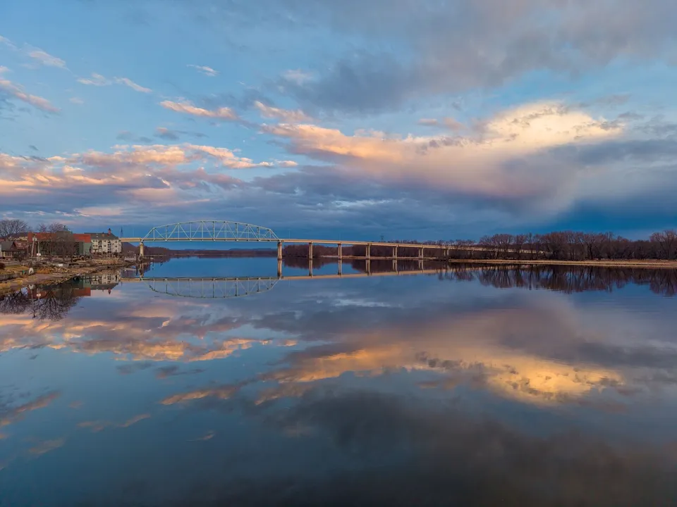
If the parks explain how people spend time, the bridge explains how Baudette connects to everything else. MnDOT says the Rainy River International Bridge between Baudette and Rainy River, Ontario was replaced and celebrated in 2020, while the historic bridge record identifies the earlier structure as a 1959 bridge. That makes the crossing more than a route across the river. It is a symbol of the town’s border role and a reminder that Baudette’s local geography is international whether a traveler is thinking about commerce, family visits, fishing access, or simply the view from the riverbank.
The bridge also helps explain why Peace Park and the waterfront matter so much. Once you know the crossing is a defining part of daily geography, the park’s view of Canada stops being a novelty and becomes part of how the town reads itself. Baudette is not trying to hide the border. It uses the border as part of its public life. That is a subtle but important difference. A town can sit near a line on the map, or it can build public places that help people notice what that line means. Baudette does the second.
A practical way to read Baudette
A newcomer can learn a lot here by asking three simple questions: Where do official errands happen? Where do people gather outdoors? Where does the town connect to the wider region? Baudette’s answer is consistent. Errands flow through county offices. Gathering happens in parks that each serve a different purpose. Connection runs through highways, the river, and the bridge. Put those together and you get a town that is shaped by public places with clear jobs, not by random development.
That is also why Baudette’s identity feels sturdy. The city’s location on Highways 11 and 172, its county seat function, its three distinct parks, and its international bridge all reinforce one another. The result is a place that can support both ordinary routines and strong local character. You do not need to know every local story to see the pattern. Start with the places that people actually use, and the town begins to make sense quickly.
If you are exploring life or work in the area, that same practical geography is useful beyond sightseeing. It tells you where services sit, how seasons shape recreation, and why border movement is part of local reality. For a current hiring question or a hiring need, you can call 218-WorkNow or email the office for verified help.