
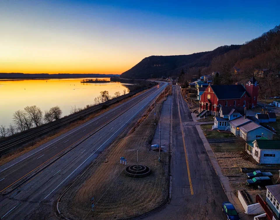
Baudette is easier to understand when you stop treating it like a single-destination town. The city identifies itself with Highways 11 and 172 south of Lake of the Woods, and that simple fact explains a lot: some trips begin on the road, some end at the water, and some change shape with the season. In Baudette, the useful question is often not “Where is everything?” but “What kind of day is this place designed for?”
That is why the town’s public places feel so practical. They are not interchangeable patches of green or scenic extras. They do different jobs. Timber Mill Community Park gives travelers and longer-stay visitors a campground option with RV and primitive camping. Peace Park looks outward, with views of Canada and the International Bridge. Bay Front Park carries a more familiar town identity because it is home to Willie Walleye. Put those three together and you get a surprisingly complete picture of Baudette: overnight base, border view, and community landmark.
A town that reads differently from the highway
A lot of places are described by what people pass through on the way somewhere else. Baudette works in the opposite direction. Because it sits south of Lake of the Woods and is identified with Highways 11 and 172, it functions as a practical hinge between movement and staying put. That matters for anyone arriving for an errand, a weekend, a reunion, or a fishing trip. The roads are not just access; they are part of the town’s organizing principle.
That road identity also keeps the town legible. You do not need a complicated mental map to get the basic shape of Baudette. You need to know that it is a place where the route and the destination are often related. If you are here for supplies, a campground, a park stop, or the river, the town’s public layout helps you make sense of the whole visit without having to cross a large, anonymous landscape to do it.
Three public places, three different purposes
The strongest local clue is that Baudette does not rely on one civic space to do everything. Instead, it spreads its public life across places with distinct uses.
Timber Mill Community Park is the clearest example of a place built for staying. The campground offers RV and primitive camping, which makes it more than a picnic area or a pass-through stop. It gives Baudette a place where an overnight plan can become part of the town’s everyday rhythm. That is useful for visitors, of course, but it also tells residents something about how the town sees itself: as a place where people can settle in for a while, not just drive by.
Peace Park serves a different purpose. Its view of Canada and the International Bridge is not only scenic; it gives the town a direct sense of border geography. That is a subtle but important part of Baudette’s identity. The park turns geography into an experience people can actually stand in. For someone new to the area, that can do more than a map ever could. It shows that Baudette is connected outward, and that the river and border are part of daily awareness, not abstract lines on paper.
Then there is Bay Front Park, home to Willie Walleye. This is the most community-facing of the three. A town mascot or landmark figure says something different from a campground or a border view. It tells you the place has a shared symbol, something people can point to without needing a long explanation. In a small town, those symbols matter. They help locals orient visitors, but they also give residents a common reference point that belongs to the town rather than to any one season.
The seasons change the use, not just the weather
Baudette also becomes more interesting when you look beyond the town itself and into the way the river shapes activity. Lake of the Woods Tourism describes spring and fall Rainy River fishing, summer boating and fishing, and winter ice fishing. Those are not just tourist labels. They show that the area is active in more than one way across the calendar.
That matters because it changes how people plan. A town with only one obvious season can feel compressed into a short burst of activity. Baudette and the surrounding area work differently. The calendar opens and closes different doors. In one season, the river is part of a fishing plan. In another, it fits boating and fishing together. In winter, the same region shifts into a different form of outdoor use. The point is not that every month looks identical. The point is that the area stays meaningful even as the purpose changes.
For a newcomer, that is useful information. It means the community is not defined by a single annual peak. For a resident, it explains why local routines can feel so tied to timing. And for a visitor, it helps answer a basic question before the trip even starts: am I coming for a road stop, a campground stay, a river outing, or a winter pattern of recreation?
What Baudette does especially well
Some towns excel at being crossed. Others excel at being visited. Baudette does both, but its real strength is that it also makes sense as a place to use. The highways give it shape. The parks give it purpose. The river seasons give it variety. Put those pieces together and the town becomes easy to read without becoming boring.
That is the useful discovery here: Baudette is not trying to be one thing. It is a town where the road, the border, the campground, the mascot, and the river all do different work. Once you see that, the place feels more understandable, and probably more welcoming too.
If you are sorting out a local hiring need or want to check verified opportunities tied to the region, you can call 218-WorkNow or email the office.